...
| Warning |
|---|
If you select only Aggregates positions in the Geographical dimension, the Map visualisation won’t be able to render itself. In this case, the following message may appear: Data cannot be viewed on a map. Geographical entities are not selected or cannot be represented. Please go to selection or modify filter. If this message appears, select at least one non-aggregate (Country, NUTS 1, NUTS 2 or NUTS 3) position to display the map and remove the error message. |
| Anchor | ||||
|---|---|---|---|---|
|
Click on Format (in the Actions area) to set the different format options of the map.
...
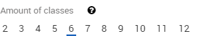
Amount of classes sets the amount of classes to be used, with a minimum of two and a maximum of sixtwelve.
| Anchor | ||||
|---|---|---|---|---|
|
...